
Student Projects
VE/VM450

Using UWB for Indoor Localization
Instructors: Prof. Chengbin Ma
Team Members: Team Members: Shuyuan Hou, Yiwen Sun, Fangqi Yuan, Ziming Zhao, Zhuoer Zhu
Project Video
Team Members

Team Members:
Shuyuan Hou, Yiwen Sun, Fangqi Yuan, Ziming Zhao, Zhuoer Zhu
Instructors:
Prof. Chengbin Ma
Project Description
Problem Statement
Indoor localization is very essential scenario for intelligent connected vehicles. However, in certain situations such as underground parking lots, GPS signals are too weak to support positioning. This project aims to use Ultra-Wide Band (UWB) sensors assembled on vehicle and in environment to localize host
vehicle in an indoor area.
vehicle in an indoor area.
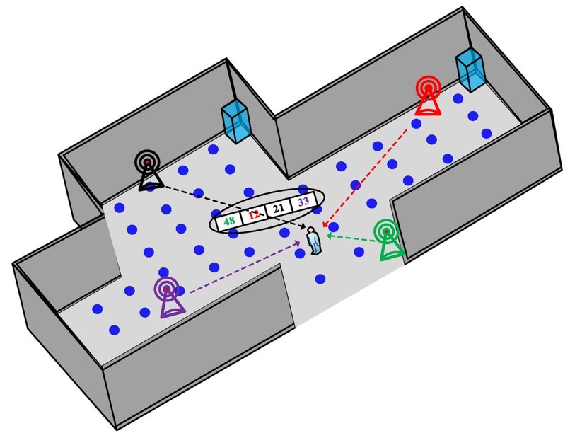
Fig. 1 Schematic diagram of indoor localization [1]
Concept Generation
As shown in Figure 2 and 3, the system acquires distance data provided by UWB sensors. Raw data is transmitted to the on-board computer and processed in Robot Operating System (ROS). Using three point localization algorithm, distance information can be transformed into positional information of the vehicle.
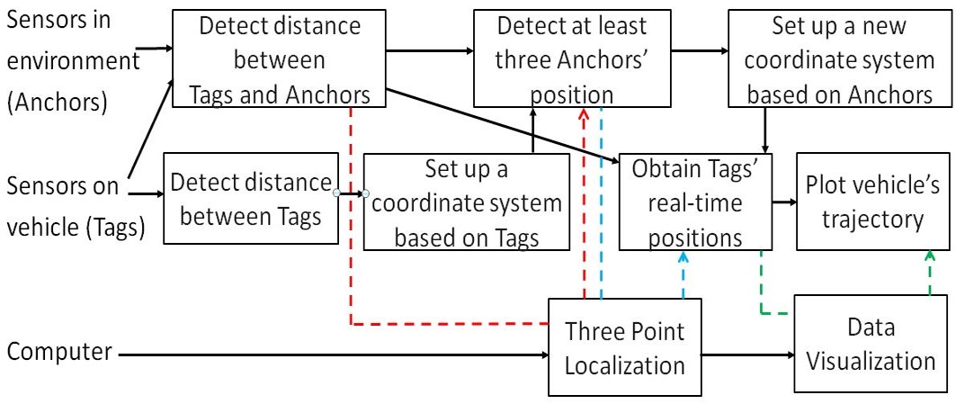
Fig. 2 Detailed structure function
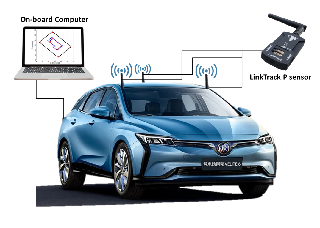
Fig. 3 Concept diagram
Design Description
Three UWB sensors will be assembled on vehicle and connected to the computer, configured as three tags with the same baud rate. As soon as the vehicle enters the scene, it starts to locate anchors in environment using three point localization algorithm. The sensors are set to DR mode, which uses the Node_frame2 protocol and provides distance data. When several (≥3) anchors are located, three of them with best performance are chosen intelligently by our program to rerun three-point localization algorithm and, in turn, locate the host vehicle’s position. Simultaneous Localization and Mapping (SLAM) algorithm is implemented to continuously detect the accessible anchors.
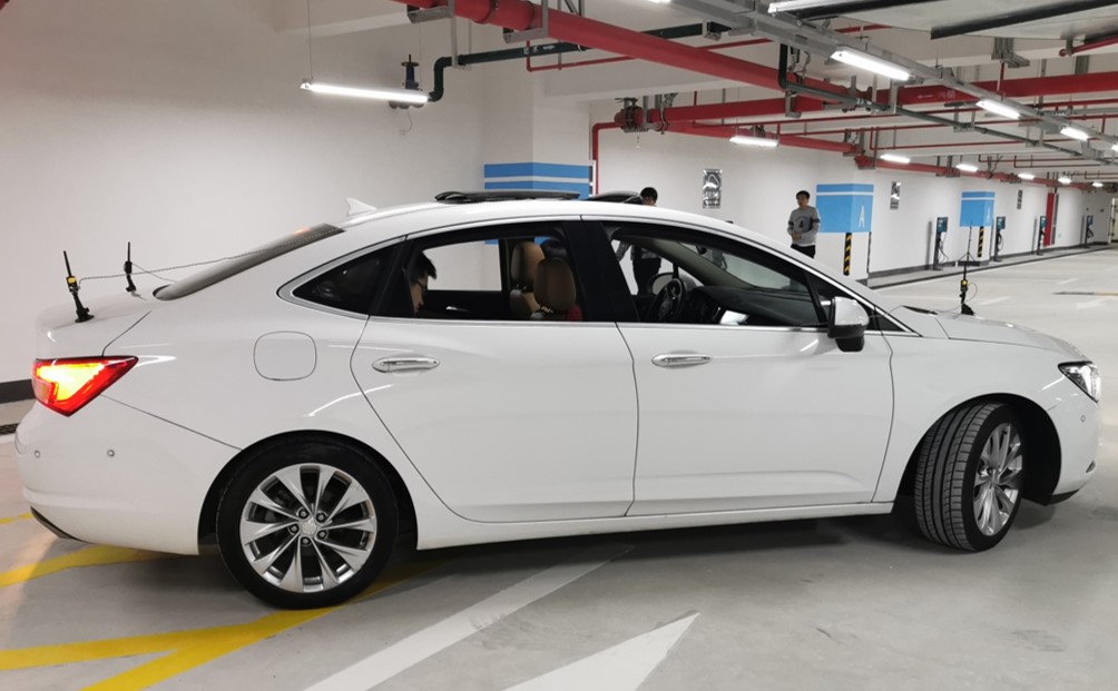
Fig.4 The whole set-up system on host vehicle
Modeling and Analysis
A graphical user interface is developed to display the real-time positional information of the host vehicle and its trajectory in the map. Figure 5 shows an example of the output.
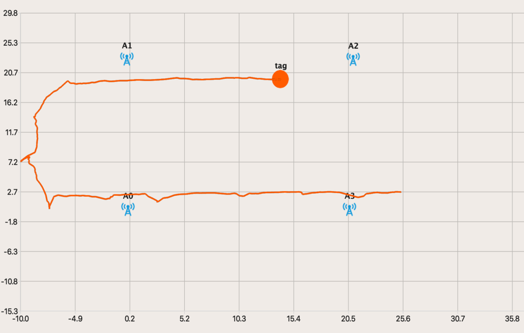
Fig. 5 Vehicle trajectory in the map
Validation
Validation Process:
For localization precision, another set of sensors configured to LP mode are used to provide the accurate trail. Both our developed system and the LP-mode sensors are set up in the scene. When the vehicle travels along a route, the two trajectories can be compared to validate the localization accuracy.
For maximum usable velocity, the system is tested multiple times under a vehicle speed of 15km/h. If the trajectory is accurate and no deflections happen, it can meet this specification.
Other specifications can also be verified using easy experiments.
Validation Results:
According to validation part, most specifications can be met.
√ Localization precision<=30cm √ Max. usable velocity>=15km/h
√ System Latency<=150ms √ Size<=100cm3 √ Weight<=150g √ Cost<=2720RMB √ Number of sensors<=3 · Power consumption<=1350mW √ means having been verified and · means to be determined.
Conclusion
Our product, an indoor localization system based on UWB sensors, makes up for the deficiency of GPS signal loss and has the advantage of high accuracy as well as stability, low cost, long life span and handy size.
Acknowledgement
Sponsor: Jason Wang from GM
Tiger Zhang, Jony Xu and Shen Li from GM
Chengbin Ma and Jianrong Xiao from UM-SJTU Joint Institute
Tiger Zhang, Jony Xu and Shen Li from GM
Chengbin Ma and Jianrong Xiao from UM-SJTU Joint Institute
Reference
[1] W. K. Zegeye, S. B. Amsalu, Y. Astatke and F. Moazzami, “WiFi RSS fingerprinting indoor localization for mobile devices,” IEEE
UM-SJTU JOINT INSTITUTE